Image: GeoSpy
GoUpSec Commentary: The emergence of photo location AI tools forces people to rethink the threat model of privacy protection and information security strategies.
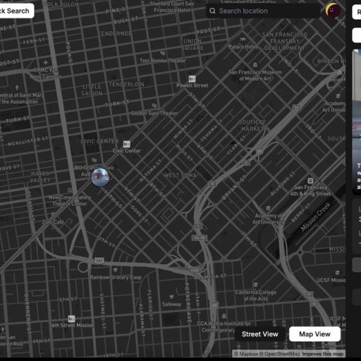
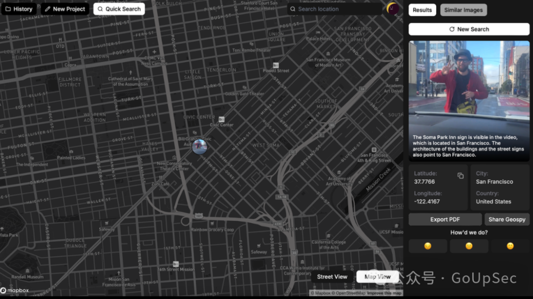
Developed by Boston’s Graylark Technologies, GeoSpy is a powerful AI tool that can accurately locate the shooting position of photos within seconds by analyzing features such as architectural styles, types of vegetation, and spatial relationships between buildings. This technology has attracted widespread attention from the public and law enforcement agencies, positioning itself to serve law enforcement, threat intelligence companies, and government agencies.
GeoSpy has been trained on millions of global images and can identify “significant geographical markers” such as specific architectural styles, soil characteristics, and their spatial arrangements. While its strengths lie in the United States, officials state that the tool has global location capabilities.
Wide Range of Applications
The capabilities of GeoSpy have been validated in several real-world cases. For example:
-
Criminal Investigation: GeoSpy successfully pinpointed a video to a specific location in San Francisco by analyzing building and street features.
-
Natural Disaster Assessment: When analyzing fire photos near Los Angeles, GeoSpy, while not completely accurate, was able to provide useful clues about terrain, building types, and coastlines.
-
Threat Intelligence: GeoSpy was used to locate the movement trajectory of tanks in the Ukrainian war zone, supporting military operations.
-
Fraud Detection: Users can verify whether property images are located in the city described in the advertisement through GeoSpy, thereby identifying fraudulent listings.
GeoSpy can even extract geographic information from images that have had their EXIF metadata removed, relying solely on internal features of the image for location. This capability breaks through the limitations of traditional methods, making it easier to track anonymous photos.
Controversy Over Open Tool
Despite the praise for GeoSpy’s technology, its openness and risk of misuse have sparked significant controversy.
In the initial public beta of GeoSpy, some users tracked others’ locations using the tool, even attempting to locate the home addresses of certain YouTube creators. Some users posted “suspicious requests” in Discord communities, such as locating the workplace of a “friend” or the residence of a certain woman. These actions raised ethical issues and became the focus of public criticism.
The widespread application of GeoSpy renders traditional privacy protection measures (such as deleting metadata) ineffective. Cooper Quintin, a senior security researcher at the Electronic Frontier Foundation (EFF), warned that such tools could be used to collect geographic information on a large scale, potentially leading to misuse or misjudgment by law enforcement, resulting in unnecessary panic and wrongful arrests.
In response to external criticism, GeoSpy has shut down its free public version, now only providing access to “law enforcement agencies, corporate users, and government entities.” However, according to founder Daniel Heinen’s messages on Discord, the law enforcement version of GeoSpy has more powerful features, capable of geofencing specific areas and generating detailed threat intelligence.
Potential Security and Legal Issues
GeoSpy offers the capability for large-scale analysis of images, but its accuracy is not entirely reliable. For instance, in some cases, the location results may not be precise, potentially misleading law enforcement actions. If this tool is used to analyze photos of non-suspects, it may infringe on citizens’ privacy rights and lead to unjust treatment of the innocent.
The EFF points out that the existence of GeoSpy reminds people to rethink threat modeling and incorporate new technologies, including geographic location AI tools, into privacy protection strategies. For example, privacy protection for high-risk populations needs to be more comprehensive.
Heinen himself acknowledged that GeoSpy could be used for malicious tracking or illegal surveillance. Although he actively shut down certain inappropriate requests in the community, the openness of the technology makes it difficult to completely eliminate such behaviors.

END
Related Articles
2025, The Year of AI for CISO
Review of Five Major AI Security Trends in 2024
AI+OSINT: Emerging Threats to Watch in 2025
CISO Report: The Current State and Prospects of AI in Cybersecurity Operations in 2024